


MODELLING MARTIAN PALEOLAKES BATHYMETRY BY PHOTOCLINOMETRY
Seminars
Semester 2
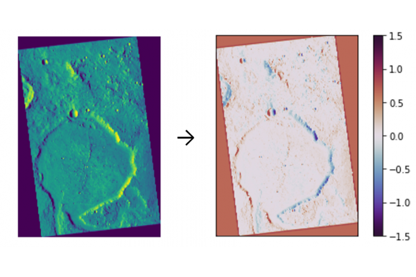
A detailed and accurate topographic modelling of terrestrial planets is essential to scientific research and exploration missions, for example, understanding their geomorphological processes, evaluating landing and exploration sites, etc. Stereo photogrammetry and laser altimetry are two of the most used methodologies for generating Digital Elevation Models (DEM). However, DEMs generated by stereo photogrammetry are prone to spikes and stair-like artifacts, thus inaccurate; and those by laser altimetry yield large sample gaps, thus lack of detail. In this research project, I propose the use of a reflectance-based method — shape from shading — to infer a very-high resolution DEM, down to 0.5 m/pixel. Such inferred product is useful for modelling Martian paleolakes bathymetry.
Additional information: Mr. TSANG Ho Ming, billyhmt@connect.hku.hk