


EXPLORING THE USE OF SLAM LIDAR FOR MEASURING WILDFIRE FUEL LOADS IN HONG KONG
Seminars
Semester 2
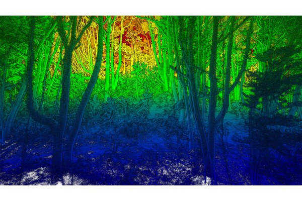
Human-ignited wildfires burn around 5% of the natural areas in Hong Kong annually. To better understand and forecast wildfire behavior, we need accurate information about fuels. Wildfire fuels are vegetation that is available to burn during a wildfire. Fuels were characterized during the 2024-2025 dry season in Kadoorie Farm and Botanic Garden. Three plots representing grassland, shrubland, and secondary forest were surveyed using mobile SLAM LiDAR mounted on a backpack, a handle, and a survey pole. LiDAR produces a three-dimensional point cloud dataset that represents the real-world vegetation and can be used to measure the fuel load for each plot. My results show that while SLAM LiDAR can be a powerful tool for surveying in forest stands, SLAM LiDAR does not perform as well in densely vegetated grassland environments. Understanding the limitations of SLAM LiDAR for measuring fuel load is important information for land managers and decision makers who utilize LiDAR for wildfire mitigation.
Additional information: Ms. Katherine Ann STRATTMAN, u3007888@connect.hku.hk